AUTODESK INFRAWORKS V2021 MULTI-MAGNiTUDE
17
April
2020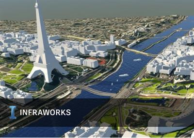
AUTODESK.INFRAWORKS.V2021.MULTI-MAGNiTUDE | 2.8 GB
The Autodesk development team is pleased to announce the availability of InfraWorks 2021 is an outstanding tool for aggregating data, visually evaluating design concepts, and communicating design intent. This release includes new and updated features, performance enhancements, known issues and fixes.
What's New in Autodesk InfraWorks 2021.0
Corridor geometry from Civil 3D
We've significantly improved data exchange between InfraWorks and Civil 3D, so that you can use full corridor geometry from Civil 3D in your InfraWorks models. This also compliments the new Civil Structures workflow.
Unified DWG and IMX import
We've enhanced the import of IMX data to improve data exchange between Civil 3D and Infraworks.
Parametric Bridge Content
We've added more parametric bridge content from Autodesk Inventor for use in your InfraWorks civil structure projects
High DPI Scaling Support
We've added High DPI scaling support and enabled it in all InfraWorks models by default. (You can use Application Options to turn this new option off).
3D Model import improvements
We've enhanced geo-referenced 3D model import to display coordinate system and rotation values from imported 3D models, such as Revit models in FBX format. This also enables interactive placement for geo-referenced 3D models.
Add-ins for Autodesk InfraWorks
- We've made improvements to the Autodesk Revit InfraWorks Updater to support civil structures workflows between InfraWorks, Autodesk Civil 3D and Autodesk Revit.
Autodesk Connector for ArcGIS
- You can now not only publish desired geometry and layer content to ArcGIS but also select attributes (and name them whatever you'd like as long as they adhere to ESRI naming conventions) when publishing InfraWorks content to the ArcGIS cloud environment. This new functionality is also available when exporting InfraWorks content to ESRI File Geodatabase format (FGDB). This provides you with more flexibility to restrict access to any sensitive information while publishing.
Civil Structures
- We've released a workflow for your civil structures that spans Autodesk Civil 3D, Autodesk InfraWorks, and Autodesk Revit. Check out the whole workflow here: Civil Structures workflow.
- We've also added the ability to have the bridge deck slope match the super elevation of an imported corridor from Civil 3D.
Collaboration
- We've enhanced support for data exchange between Autodesk InfraWork, Autodesk Civil 3D, and Autodesk Revit. Check out the Data Exchange section of the help for more information.
Data Exchange with Civil 3D
- We've added 38 rules to support mapping Civil 3D subassemblies and components to InfraWorks component roads.
- We added the Corridor Component Road road option to the InfraWorks Data Source Configuration dialog for imported Civil 3D road data. This allows you to use full Civil 3D corridor geometry in InfraWorks.
- We've enabled additional Grading options for corridor component roads, the new options being: No Surface Interaction or Extended Grading.
General
- All toolbar icons are restyled to support high DPI scaling and fun colors.
Road Design
- In the Application Options dialog, Unit Configuration page we have added 'US survey feet' as an option to the Type dropdown list on the Transportation tab. Previously station annotations were in International feet which caused a minor discrepancy between the station labels and the actual road data.
- In the Profile View when hovering the cursor over a non-editable gizmo on a PVI, BVC or EVC the cursor will be displayed as the "Forbidden" symbol.
- The effected "Add Curve" command is on the Road context menu. The command will be displayed on the menu as long as the cursor location can be projected onto a horizontal tangent of the selected road. This change allows the user to control the location of the PI of the curve being added using the cursor position. In previous versions the command was only displayed whn the cursor was over the centerline of the road which limited where the curve could be added.
General
Fixed an issue in the New Model dialog that was preventing coordinate system selection in the Settings tab when using InfraWorks with high display resolution.
Fixed an issue that caused items to appear in grayscale instead of color when pinning a toolbar action to the Quick Access menu bar.
We've added a warning message to notify you if your system is using outdated graphics card drivers.
Fixed an issue where the Model Properties dialog was cutting off the display of buttons on the bottom of the dialog.
ArcGIS
We resolved a data offset issue that occurred for models with unsupported coordinate systems when publishing data to an ArcGIS Portal.
Civil Structures
Fixed an issue where orbital navigation in your model was not available when the Publish Civil Structures dialog was open.
Fixes an issue where the pier diaphragm width attribute was not being properly translated into other languages for non-English (US) usage of InfraWorks.
Fixed an issue where part catalog names and tooltips were inaccurate after importing a part catalog into InfraWorks.
Drainage Design
Fixed an issue where the edit state for Pipeline features was not updating correctly.
Point Clouds
Fixed an issue where extracting linear features from point cloud data with the Cross Section View panel open would cause InfraWorks to unexpectedly close.
Fixed an issue where InfraWorks would unexpectedly close when importing improperly-formatted CSV data with the Point Cloud Image Lookup tool.
Road Design
Fixed an issue where coverage materials for corridor component roads were not supported for imported IMX data from Autodesk Civil 3D.
Fixed an issue that caused unexpected behavior when importing road models with horizontal and vertical alignments of different lengths from Autodesk Civil 3D.
Fixed an issue where Right of Ways could be created with invalid self-intersecting geometry when using the Parallel Drawing.
Fixed an issue where the right-click context menu for selected component roads was too narrow to display all text.
Autodesk InfraWorks is the geospatial and engineering BIM platform that enables parametric model-based planning and design of civil infrastructure in the context of the real-world. With InfraWorks users can more easily evaluate and convey design intent within the context of a project's surroundings; data can be aggregated from various sources and design decisions made earlier in the project lifecycle;~ then, the design model can be moved downstream to AutoCAD Civil 3D for detailed design and construction documentation with minimal loss of critical information - improving decision making, project stakeholder buy-in, and saving both time and money.
The latest release of InfraWorks now uses the power and precision of Civil 3D for corridor models. These upgrades include:
- Importing all calculated design elements or select elements of the Civil 3D corridor intoInfraWorks directly
- Define the mapping of materials to apply to the corridor shapes
- Placing corridors into their contextual environment
- Seamless updates to the road in InfraWorks when the Civil 3D corridor changes
- And more downstream benefit
What's New in InfraWorks (2021): Corridor Enhancements
Download Links:

https://rapidgator.net/file/50eba2ffea1bdbec7dcc208720f21f80/AUTODESK.INFRAWORKS.V2021.MULTI-MAGNiTUDE.part1.rar.html
https://rapidgator.net/file/5e60e41853e9bb4c236cf448825b9ee1/AUTODESK.INFRAWORKS.V2021.MULTI-MAGNiTUDE.part2.rar.html
https://rapidgator.net/file/3a2d60044930cdcb9c99440e70549c9d/AUTODESK.INFRAWORKS.V2021.MULTI-MAGNiTUDE.part3.rar.html
https://rapidgator.net/file/fd4c1dd050f0090ad45c053156ebf8bc/AUTODESK.INFRAWORKS.V2021.MULTI-MAGNiTUDE.part4.rar.html

http://www.filefactory.com/file/1u2f6d95yt9x/n/AUTODESK.INFRAWORKS.V2021.MULTI-MAGNiTUDE.part1.rar
http://www.filefactory.com/file/5qq4pqwpbm95/n/AUTODESK.INFRAWORKS.V2021.MULTI-MAGNiTUDE.part2.rar
http://www.filefactory.com/file/5lbds89w1lit/n/AUTODESK.INFRAWORKS.V2021.MULTI-MAGNiTUDE.part3.rar
http://www.filefactory.com/file/150ebhhpvg95/n/AUTODESK.INFRAWORKS.V2021.MULTI-MAGNiTUDE.part4.rar

https://nitroflare.com/view/05E115BE2816A2B/AUTODESK.INFRAWORKS.V2021.MULTI-MAGNiTUDE.part1.rar
https://nitroflare.com/view/EF69145F0854B55/AUTODESK.INFRAWORKS.V2021.MULTI-MAGNiTUDE.part2.rar
https://nitroflare.com/view/648842CFE8C5206/AUTODESK.INFRAWORKS.V2021.MULTI-MAGNiTUDE.part3.rar
https://nitroflare.com/view/90D87A8721A3C5A/AUTODESK.INFRAWORKS.V2021.MULTI-MAGNiTUDE.part4.rar
Note:
Only Registed user can add comment, view hidden links and more, please register now
Only Registed user can add comment, view hidden links and more, please register now